Castillo de Santa Bárbara, Castillo de Guanapay

Voriges Foto
Lanzarote
Nächstes Foto
Lanzarote, Castillo de Santa Bárbara, Castillo de Guanapay - mittelmeer-reise-und-meer.de

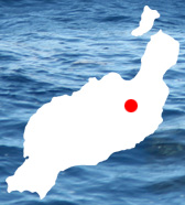
Das Castillo de Santa Bárbara befindet sich auf dem Rand des Kraters des Guanapay, weshalb es auch Castillo de Guanapay genannt wird. Aus einer Höhe von knapp 500 Metern kann man, gute Sicht vorausgesetzt, die Ostküste sowie die Westküste überwachen. Das hat man sich zu Nutze gemacht und zum Schutze dieses Castillo errichtet. Viel scheint es nicht genutzt zu haben, denn die Piraten haben die alte Hauptstadt Teguise trotzdem plattgemacht. Hat wohl an der schlechten Sicht gelegen.
Seitdem ist Teguise auch nicht mehr die Hauptstadt von Lanzarote, seit 1852 ist es das an der Ostküste gelegene Arrecife.

Lanzarote, Castillo de Santa Bárbara, Castillo de Guanapay - mittelmeer-reise-und-meer.de
Dieses Foto ist folgenden Themen zugeordnet:
Lanzarote, Castillo de Santa Barbara, Atlantik, Kanaren, Spanien,
Foto-ID: "lanzarote - lanzarote-castillo-santa-barbara-guanapay"
Quelle: Canon 5D
Voriges Foto
Lanzarote
Nächstes Foto
 Castillo de Santa Bárbara bei Teguise im Zentrum von Lanzarote

Koordinaten

Koordinaten:
29° 3' 28.559'' N
13° 33' 0.328'' W
  (29.057933,-13.550091)
Klimatabelle
Lanzarote
Höchste Tagestemperatur °C
20
 
21
 
22
 
22
 
24
 
26
 
28
 
29
 
29
 
26
 
24
 
21
 
J F M A M J J A S O N D
Niedrigste Tagestemperatur °C
13
 
13
 
14
 
15
 
16
 
18
 
20
 
20
 
20
 
18
 
16
 
14
 
J F M A M J J A S O N D
Wassertemperatur °C
18
 
18
 
17
 
17
 
18
 
20
 
21
 
21
 
22
 
22
 
20
 
19
 
J F M A M J J A S O N D
Sonnenstunden pro Tag
7
 
7
 
7
 
8
 
9
 
9
 
9
 
9
 
7
 
7
 
7
 
6
 
J F M A M J J A S O N D
Regentage im Monat
3
 
2
 
2
 
1
 
0
 
0
 
0
 
0
 
1
 
1
 
4
 
5
 
J F M A M J J A S O N D